


Less than 24 hours after the state Senate maps appeared online a committee approved the proposed changes and sent the maps to the full Senate for their review.
The map does not pit incumbents against one another, but it does make substantial changes from the current map, which was adopted in 2013.
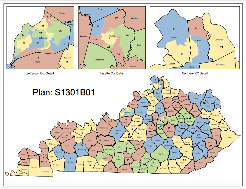
With 4.5 million people living in the commonwealth in the latest census lawmakers have shifted districts to ensure equal representation in the legislature. The Senate maps aim to split as few counties as possible and adhere to districts with about 118,574 people in each of the 38 Senate districts.
The proposed map:

Overall the maps are substantially different in several areas of the state, including Northern Kentucky where lawmakers have split Boone County in half. They have also carved Kenton County into three districts, and have not substantially altered Campbell County, in the county-level map.
Boone County as proposed in the map on the left, and as currently drawn in the map on the right.
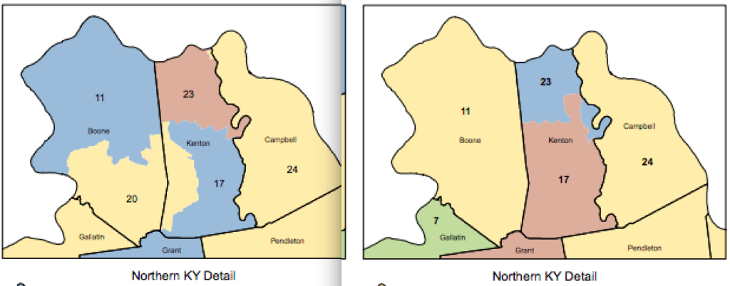
Senate District 11 is currently represented by Sen. John Shickel, R-Union, who would continue to represent the 11th District in the newly drawn map. The 20th Senate District is currently represented by Sen. Paul Hornback, R-Shelbyville, who is not seeking re-election.
The proposed Senate map creates a new vacant 20th Senate District out of Franklin, Owen, Carroll, Gallatin, and part of Boone and Kenton County.
The 17th Senate District is represented by Senate Majority Floor Leader Damon Thayer, R-Georgetown, if the map is adopted his district will contain a slimmer part of Kenton County, all of Grant County, Scott County, and a new northwestern portion of Fayette County.
The 24th Senate District is currently represented by retiring Sen. Wil Schroder, R-Wilder. The 24th District currently encompasses Campbell, Pendelton, and Bracken County that district does not change according to the county-level map.
Jefferson County will also look different in the proposed Senate map. The proposed version of the map is on the left, and the current map is on the right in the image below.
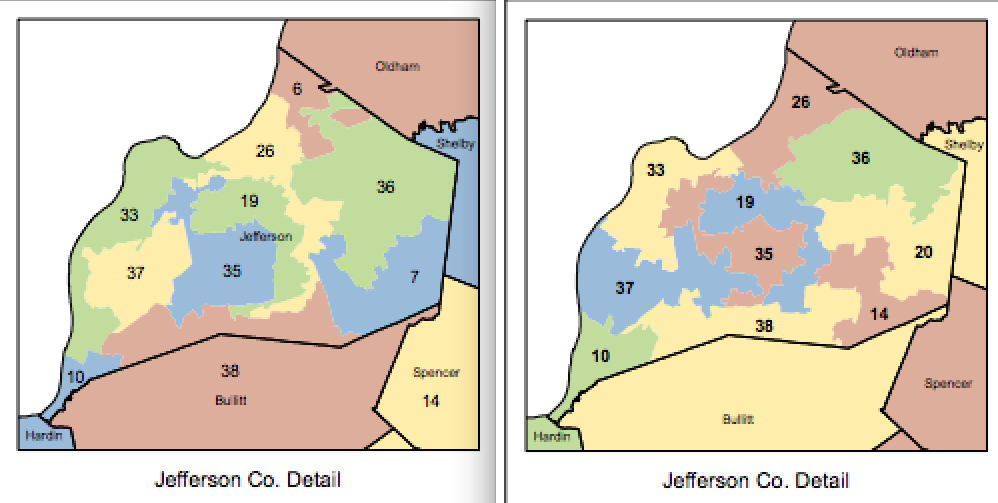
The 33rd Senate District which is represented by Sen. Gerald Neal, D-Louisville, will now border more of the Ohio River as the district skirts the western portion of the county. Another Democratic district, the 37th District held by Sen. David Yates, D-Louisville, shifts in the map to share a more compact and contiguous border with the new 35th District which is represented by Sen. Denise Harper Angel, D-Louisville. Sen. Morgan McGarvey’s district also remains largely intact in the map.
On the eastern border of Jefferson County, a new 7th Senate District pops up taking a portion of the old 14th and 20th Districts. The new 7th, which is currently held by Sen. Adrienne Southworth, R-Lawrenceburg, picks up the open Shelby County area and adds in Anderson, Shelby, and Henry County to the North.
Sen. Julie Raque Adams, R-Louisville, sees her 36th District Senate area grow across eastern Jefferson County losing a portion to a newly crafted 6th District seat, a number carries over from west Kentucky where retiring Sen. C.B. Embry, R-Morgantown, currently holds Butler, Hopkins, Muhlenberg, and Ohio County. The new 6th District will include the small portion of northeast Jefferson County, and all of Oldham and Trimble Counties.
Fayette County will also be carved up in the new Senate map. The newly proposed map is on the left, and the current map is on the right.
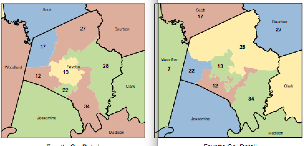
Republicans have sliced Fayette County seven ways. They are protecting the open 12th Senatorial District created by the retirement of Sen. Alice Forgy Kerr, R-Lexington, for their desired candidate Amanda Bledsoe. A portion of the county will still be in the 22nd District, which is represented by Sen. Donald Douglas, R-Nicholasville, who was recently elected to fill the unexpired term of the late Sen. Tom Buford. The 28th District, represented by Sen. Ralph Alvarado, R-Winchester, shrinks to the eastern part of Fayette County in the new map. The 28th will still contain Clark County and Montgomery County, but it will now also contain Bath and Menifee County. The 34th District keeps Madison and part of Fayette County but loses Rockcastle County in the new map.
Warren County will also be carved in the new map. Once a standalone county, it has now overgrown the proportional size and is cut three ways in the newly proposed map.